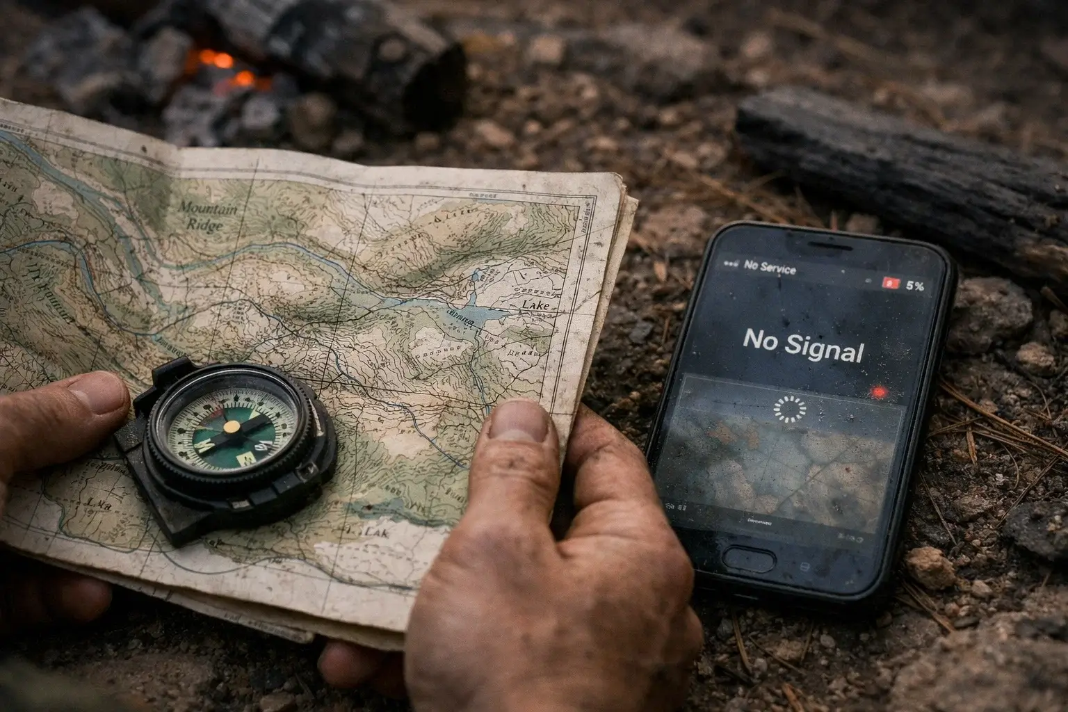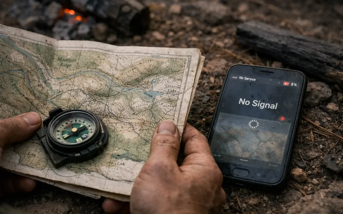
Your survival currently hangs on a fragile tether of satellites managed by a government that cannot guarantee your safety and a phone that will become a useless brick the moment the grid fluctuates. You are being tracked, mapped, and funneled into “efficient” corridors that serve the state’s logistics, not your family’s evacuation. Digital maps are designed to keep you on the pavement, the most dangerous place to be during a mass exodus. In a crisis, the roads are not routes; they are traps. If you are relying on a glowing screen to tell you where to go, you have already surrendered your autonomy to a system that will prioritize military and emergency hardware over your civilian device. The signal will drop, the battery will die, and the “blue dot” that represents your life will vanish, leaving you blind in a landscape you only thought you knew.

Modern GPS applications are optimized for commerce and traffic flow, intentionally smoothing over the “inconvenient” details of the terrain. They hide the very features that offer survival: the steep embankments, the seasonal drainage culverts, and the narrow choke points where a crowd becomes a catastrophe. By trusting a digital interface, you are choosing to remain ignorant of the physical reality of the ground beneath your feet. True security requires a return to the tactile, unhackable, and permanent record of the earth. Inaction in securing physical, high-resolution topographical data is a choice to remain a prisoner of the paved road.
The Fatal Flaw of Digital Navigation and the 1:24,000 Reality
Every digital map you use is a filtered version of reality, scrubbed of tactical data to make the interface “user-friendly.” These systems operate on the assumption of a stable environment where help is a phone call away and the power never fails. That world is gone. The USGS 7.5 minute quadrangle maps, scaled at 1:24,000, are the only civilian-accessible documents that provide the granular detail necessary for tactical movement. At this scale, one inch on the paper represents exactly 2,000 feet on the ground. This is not a “general idea” of where you are; it is a mathematical blueprint of the environment. While your phone shows a flat line for a highway, the 1:24,000 topo map reveals the 40-foot drop-off on either side of that highway that makes an off-road escape impossible for your vehicle.
The USGS (U.S. Geological Survey) created these quadrangles through decades of boots-on-the-ground surveying. They include contour lines that represent elevation changes, information that is critical when you are moving on foot or trying to hide a campsite from line-of-sight detection. If you cannot read a contour line, you cannot see the “saddle” in the ridge that allows for a low-profile crossing. You are exposed to anyone with the high ground. Stockpiling these maps for your specific county and the surrounding four counties is the only way to ensure that your “Plan B” doesn’t lead you into a box canyon or a marsh that your GPS labeled as “green space.”
Exploiting the Invisible Infrastructure: Culverts and Choke Points
Survival often depends on using the infrastructure that the general public ignores. Your GPS will never show you a drainage tunnel, but a 1:24,000 scale map will. In American suburban and rural planning, massive culverts and drainage systems are built to handle 100-year floods. These are “hidden” highways. Under extreme stress or civil unrest, the surface roads will be monitored, blocked, or jammed with abandoned vehicles. A tactical map allows you to identify where these drainage systems intersect with your path. These are routes of ingress and egress that allow for movement under the cover of the earth, completely invisible to aerial drones or surface patrols.
Furthermore, these maps expose “Choke Points”, geographical features like narrow bridges, steep-walled valleys, or single-entry points into neighborhoods. In a collapse, these locations are controlled by whoever gets there first. If your route relies on a single bridge over a “blue line” (a creek or river on your map), and that bridge is a choke point, you are walking into a bottleneck. The 1:24,000 map allows you to find the “dead space”, areas where the terrain blocks the view from the road, permitting you to bypass these hazards. Relying on an automated route is an invitation to be intercepted at a predictable location.
The Archive of the Past: Why Historical USGS Maps are Essential
You must not only stockpile the modern “US Topo” series but also the Historical HTMC (Historical Topographic Map Collection) versions from the mid-20th century. Modern automated mapping often “cleans up” the map by removing old logging roads, decommissioned rail lines, and forgotten well sites to save space. For a survivor, this deleted data is pure gold. An old logging road that has been removed from modern digital databases still exists as a physical path through the woods. It is a route that no one else knows about because it isn’t on their phone.
- Decommissioned Wells: Historical maps mark “W” or “Springs” that have since been capped or ignored. In a water crisis, these locations are your only hope.
- Old Rail Grades: These offer the most level paths through mountainous terrain, often cutting through ridges that would otherwise be impassable on foot.
- Ruins and Foundations: Knowing where a 1950s-era farmstead once stood provides potential shelter and hidden caches that modern satellite imagery misses due to canopy cover.
Technical Sovereignty: The Grid, the Plotter, and the Compass
Your map stockpile is only as good as your ability to use it without a computer. The U.S. National Grid (USNG) system is printed on the margins of USGS quadrangles. This grid allows for “Point-to-Point” communication with others. If you tell a contact a 10-digit grid coordinate, they can find you within one meter on a matching physical map. This is how you coordinate without a functioning cell tower. However, you cannot simply print these maps on a standard 8.5×11 home printer. Doing so distorts the scale, making your compass work and distance calculations dangerously inaccurate.
To secure your “Tactical Archive,” you must download the GeoPDF files from the USGS TopoView system and take them to a professional plotter. Request a full-scale 24×29 inch plot. This ensures that the 1:24,000 scale remains intact. Once printed, these maps must be treated as life-saving equipment. Paper is vulnerable to the elements, the same rain that ruins your visibility will dissolve an unprotected map.
- Lamination: Rigid but permanent protection against moisture and tearing.
- Map Sealants: Chemical coatings like Nikwax that make the paper shed water while remaining foldable.
- Red-Light Reading: Ensure you have a dedicated red-light headlamp for nighttime map study; white light at night is a “flare” that announces your position for miles in a dark-sky environment.
The Shrinking Window for Physical Acquisition
The ability to access and print these maps is tied to a functioning internet and commercial printing services. This is a finite window. As the economy shifts and digital dependency increases, the availability of high-quality large-format printing will decrease. Waiting until a crisis begins to “find a map” is a death sentence. By the time the panic starts, the shops will be closed, and the USGS servers will be overloaded or restricted for “official use only.”

Ownership of the land begins with the knowledge of the land. If you do not have a physical archive of your county’s topography, you are a guest in your own home, subject to the whims of whoever controls the digital infrastructure. The maps are the only thing that will remain true when the screens go dark. Every day you delay in building this archive, you are gambling that the satellites will stay up and the power will stay on. That is a bet that history proves, eventually, everyone loses.
Your responsibility is to your family’s safety. A USGS 7.5 minute quadrangle is not a piece of paper; it is the only unhackable, un-trackable, and unfailing guide to the world as it actually exists. Secure your county. Secure your exit. Secure the maps before the system decides you don’t need to see what’s really out there.
The Video Every Prepper’s Talking About: